What is a GIS Technician?
A GIS (Geographic Information System) technician is responsible for collecting, analyzing, and managing geographic data using specialized software tools and techniques. They work with various types of spatial data, including maps, satellite imagery, aerial photographs, and survey data, to create and maintain digital maps and databases. They may also perform data analysis, spatial modeling, and cartographic design to create maps and visualizations for use in planning, decision-making, and research across various industries such as urban planning, environmental management, public health, and natural resource management.
GIS technicians leverage geographic data to address complex spatial problems and inform policies and strategies for managing resources, mitigating risks, and improving quality of life in communities.
What does a GIS Technician do?
Duties and Responsibilities
The duties and responsibilities of a GIS technician can vary depending on the specific role and organization, but generally include:
- Data Collection and Acquisition: GIS technicians collect, acquire, and compile geographic data from various sources, including maps, satellite imagery, aerial photographs, GPS surveys, and field observations. They may use specialized equipment and software to digitize, georeference, and validate spatial data to ensure accuracy and completeness.
- Data Management and Maintenance: GIS technicians manage and maintain GIS databases, including organizing, storing, and updating spatial data layers and attribute information. They may develop data schemas, establish data standards, and implement quality control measures to ensure the integrity and reliability of GIS data.
- Spatial Analysis and Modeling: GIS technicians perform spatial analysis and modeling to analyze geographic patterns, trends, and relationships within spatial data. They use GIS software tools and techniques to conduct proximity analysis, overlay analysis, spatial interpolation, and network analysis to address specific research questions or planning needs.
- Map Creation and Visualization: GIS technicians create maps, charts, and visualizations to communicate spatial information and analysis results effectively. They design and produce maps for use in reports, presentations, and decision-making processes, incorporating cartographic principles and design aesthetics to enhance clarity and readability.
- Technical Support and Training: GIS technicians provide technical support and training to users of GIS software and tools within their organization. They may assist users in troubleshooting technical issues, developing workflows, and accessing and interpreting GIS data and analysis results.
- Project Coordination and Collaboration: GIS technicians collaborate with other professionals, such as urban planners, environmental scientists, civil engineers, and government officials, to support planning and decision-making processes. They may participate in interdisciplinary teams, contribute to project planning and design, and coordinate data sharing and integration efforts.
- Research and Development: GIS technicians may engage in research and development activities to explore new methods, technologies, and applications for GIS data and analysis. They may investigate emerging trends in GIS technology, evaluate software tools and platforms, and contribute to the development of innovative solutions to address spatial challenges and opportunities.
Types of GIS Technicians
While there may not be official "types" of GIS technicians in the same way as other professions, GIS technicians can specialize in various areas based on their skills, expertise, and the industries they work in. Some common types or specializations of GIS technicians include:
- Cartographer: Cartographic GIS technicians specialize in map creation and design, focusing on producing high-quality maps, charts, and visualizations to communicate spatial information effectively. They use cartographic principles, design aesthetics, and GIS software tools to create maps for use in reports, presentations, and decision-making processes.
- Remote Sensing Technician: Remote sensing GIS technicians specialize in analyzing satellite imagery, aerial photographs, and other remote sensing data to extract information about the Earth's surface and environment. They use image processing techniques and GIS software tools to interpret remote sensing data, classify land cover, and monitor changes in the landscape over time.
- Geospatial Information Scientist: Geospatial information scientists employ geospatial analysis, remote sensing, and spatial statistics to extract meaningful insights from spatial data and address complex spatial problems. They play a significant role in various fields, including environmental science, urban planning, natural resource management, and emergency management.
- Urban Planner: GIS technicians specializing in urban planning focus on using GIS technology to support urban planning and development projects. They analyze demographic data, land use patterns, transportation networks, and infrastructure systems to inform urban planning decisions, such as zoning, land use planning, and transportation planning.
- GIS Database Manager: GIS technicians specializing in database management focus on managing and maintaining GIS databases, including organizing, storing, and updating spatial data layers and attribute information. They develop data schemas, establish data standards, and implement quality control measures to ensure the integrity and reliability of GIS data.
- Geodatabase Administrator: Geodatabase GIS technicians specialize in administering geodatabases, which are specialized databases used to store and manage spatial data in GIS software. They design and maintain geodatabase schemas, establish data relationships, and optimize database performance to support GIS data management and analysis.
- Environmental GIS Technician: Environmental GIS technicians specialize in applying GIS technology to address environmental issues, such as natural resource management, conservation planning, and environmental monitoring. They use GIS software tools and spatial analysis techniques to assess environmental impacts, analyze ecological data, and support environmental planning and decision-making processes.
GIS technicians have distinct personalities. Think you might match up? Take the free career test to find out if GIS technician is one of your top career matches. Take the free test now Learn more about the career test
What is the workplace of a GIS Technician like?
The workplace of a GIS technician can vary depending on the industry, organization, and specific role, but it typically involves a combination of office-based work and fieldwork. In the office, GIS technicians spend much of their time working at a computer, where they use GIS software tools to manage, analyze, and visualize geographic data. They may work in a variety of settings, including government agencies, engineering firms, environmental consulting companies, utility companies, or research institutions.
In the office environment, GIS technicians collaborate with colleagues, such as GIS analysts, data scientists, engineers, urban planners, and environmental scientists, to support various projects and initiatives. They may participate in team meetings, project discussions, and planning sessions to coordinate GIS activities and share insights about spatial data analysis and interpretation. Additionally, GIS technicians may communicate with clients or stakeholders to gather requirements, present analysis results, and provide technical support and expertise.
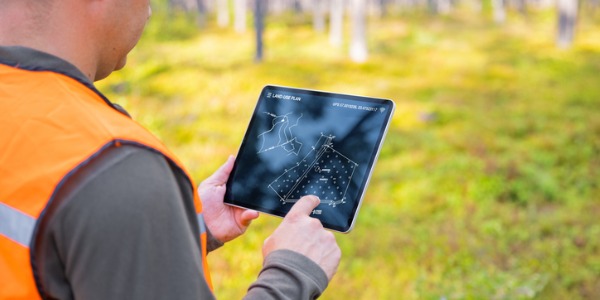
Fieldwork is also an integral part of the workplace for many GIS technicians, especially those involved in data collection, surveying, or validation activities. Depending on the nature of the project, GIS technicians may conduct field surveys, collect GPS data, or verify the accuracy of spatial data through ground-truthing or site visits. Fieldwork allows GIS technicians to gather firsthand information about geographic features, land use patterns, or infrastructure assets, which they can then incorporate into GIS databases and analysis workflows.
GIS Technicians are also known as:
Geographic Information System Technician
GIS Tech